

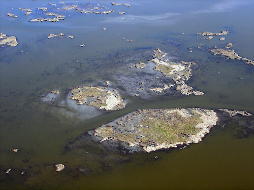
Degrading wetlands in coastal Louisiana
Due to land subsidence and sea level rise, rapid wetland loss starts as wetland breakup and increase in open water
Coastal Louisiana hurricane coastal processes erosion geomorphology mud flat| Property | Value |
|---|---|
| Author(s) | Tim Carruthers |
| Author Company | Integration and Application Network |
| Date Created | 2005-11-19 |
| Album | Processes > Physical |
| Type | Photo |
| Dimensions | 2592 x 1944 |
| Filesize | 5.5 MB |
| Number of Downloads | 329 |
| Filetype(s) | JPG |
| License | Attribution-ShareAlike 4.0 International (CC BY-SA 4.0) |
| Required Attribution | Tim Carruthers, Integration and Application Network (ian.umces.edu/media-library) |